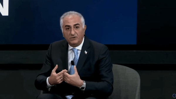
اظهارات بیشرمانه رضا پهلوی: جنگ آمریکا و اسرائیل برای ما یک عامل نجات بخش است و نه یک تعرض جنگی! چکمه نیروهای خارجی باید به خاک ایران برسد!
6 MB


محمد منصورمقدم Replied
@akhbarefori17 May 2026اظهارات بیشرمانه رضا پهلوی: جنگ آمریکا و اسرائیل برای ما یک عامل نجات بخش است و نه یک تعرض جنگی! چکمه نیروهای خارجی باید به خاک ایران برسد!6 MB
@mqdm_ir17 May 2026Replying toمتاسفانه ایموجی "😡" برای ریاکشن به این پست بههیچوجه کافی نیست از مسئولان ویراستی ( @Anjidani ) تقاضا داریم برای چنین پستهایی ریاکشنهای بهتری در نظر بگیرند :)
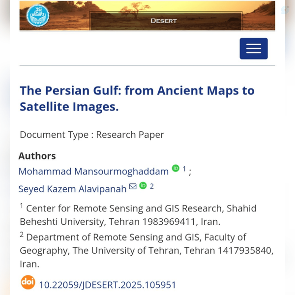
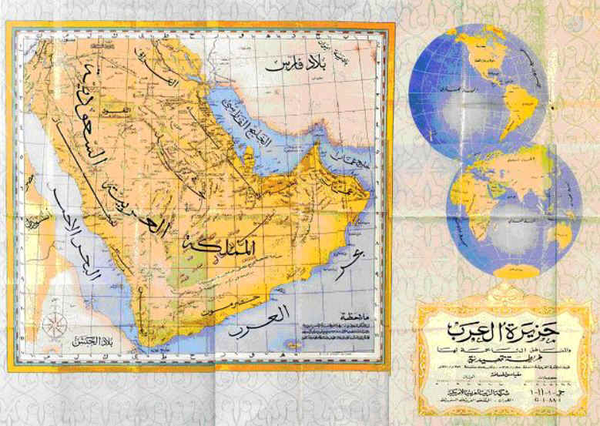
@mqdm_ir27 February 2026خلیج فارس: از نقشههای تاریخی تا تصاویر ماهوارهایجمعی از پژوهشگران از دانشگاه شهید بهشتی و دانشگاه تهران، در مقالهای تازهمنتشرشده، برای اولین بار و بصورت متمرکز، با استناد همزمان به نقشههای تاریخی چند هزارساله و در تلفیق تصاویر ماهوارهای مدرن، نشان دادهاند که خلیج فارس از نظر نام، موقعیت و سا…Show moredoi.orgThe Persian Gulf: from Ancient Maps to Satellite Images.
The Persian Gulf, as a semi-enclosed marginal sea of the Indian Ocean, has long been regarded by historical geographers and cartographers as a distinct geographic phenomenon. This study aims to integrate historical cartographical sources with satellite imagery and geographical information systems (GIS) to investigate the spatial continuity and geographical stability of the Gulf from antiquity to the present.. Historical maps, obtained from the National Cartography Center of Iran (NCC) and the Circle of Ancient Iranian Studies (CAIS) and spanning from classical antiquity to the early modern period, were analyzed to document patterns of geographic depiction and labeling of the Persian Gulf across different cartographic sources. Contemporary geospatial analyses were conducted using 17 Landsat-8 and Landsat-9 scenes to generate a satellite-based mosaic, from which key spatial characteristics including area, maximum length, average width, and coastline distribution in Iran, Iraq, Kuwait, Saudi Arabia, Bahrain, Qatar, the United Arab Emirates, and Oman were derived. In addition, the geometric centroid and Standard Deviational Ellipse (SDE) were calculated to assess the overall spatial configuration and directional distribution of the Persian Gulf. The results indicate a high degree of consistency in the location, extent, and geometric characteristics of the region over time, with a pronounced spatial association along the northern coastline. The close correspondence between historical cartographic representations and satellite-derived spatial metrics highlights the continuity of the geographic feature commonly identified as the Persian Gulf. By linking ancient maps with contemporary remote sensing data, this study provides a spatially explicit perspective on the long-term cartographic representation of the Persian Gulf.
@fatimakarimid15 May 2026Replying to and 4 others⚜️بازنشر ویراست شما در کانال #ویراستنگارهhttps://ble.ir/virast_negareh/5898691157668496925/1778837623139
محمد منصورمقدم Replied
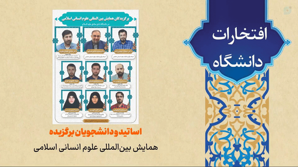
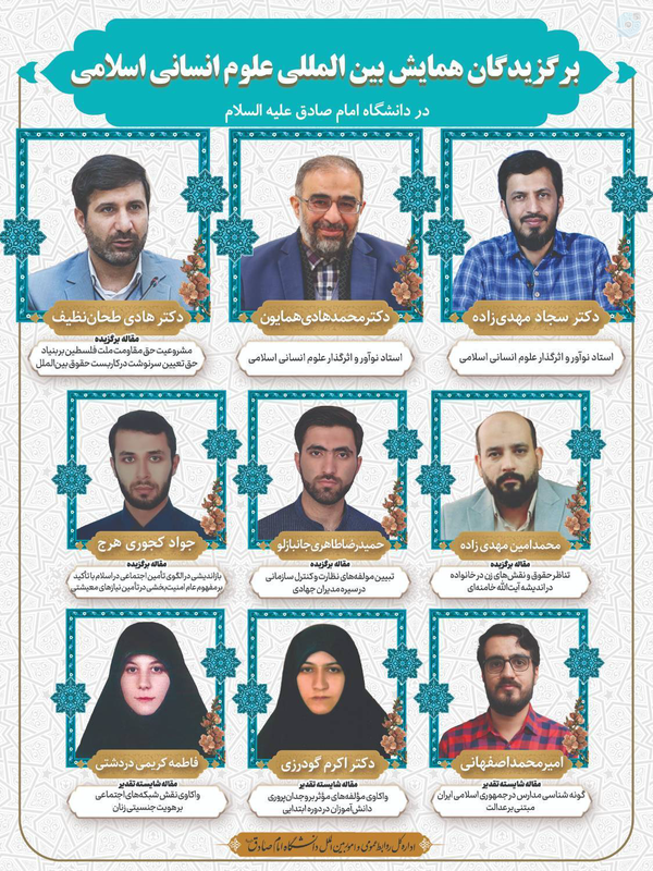
@fatimakarimid10 May 2026⚜افتخارات دانشگاه امام صادق (ع) در سال ۱۴۰۴🎥 افتخارات و دستاوردهای دانشگاه امام صادق علیهالسلام در حوزههای علمی، فرهنگی و اجرایی در سال ۱۴۰۴💠دانشگاه امام صادق علیهالسلام16 MBافتخار آفرینی اساتید و دانشجویان #دانشگاه_امام_صادق (ع) در همایش بینالمللی علوم انسانی اسلامیدر اختتامیه این همایش که در جهت پاسداشت پژوهشهای برجسته در حوزه علوم انسانی اسلامی برگزار میشود، آثار و چهرههای برگزیده این دوره از جشنواره معرفی شدند.شرح خبر:https://isu.ac.ir/content/14813/
محمد منصورمقدم Replied
@fatimakarimid5 May 2026Replying to⚜️بازنشر ویراست شما در کانال #ویراستنگارهhttps://ble.ir/virast_negareh/-6552152063596534655/1778007464889
@mqdm_ir27 February 2026خلیج فارس: از نقشههای تاریخی تا تصاویر ماهوارهایجمعی از پژوهشگران از دانشگاه شهید بهشتی و دانشگاه تهران، در مقالهای تازهمنتشرشده، برای اولین بار و بصورت متمرکز، با استناد همزمان به نقشههای تاریخی چند هزارساله و در تلفیق تصاویر ماهوارهای مدرن، نشان دادهاند که خلیج فارس از نظر نام، موقعیت و سا…Show moredoi.orgThe Persian Gulf: from Ancient Maps to Satellite Images.
The Persian Gulf, as a semi-enclosed marginal sea of the Indian Ocean, has long been regarded by historical geographers and cartographers as a distinct geographic phenomenon. This study aims to integrate historical cartographical sources with satellite imagery and geographical information systems (GIS) to investigate the spatial continuity and geographical stability of the Gulf from antiquity to the present.. Historical maps, obtained from the National Cartography Center of Iran (NCC) and the Circle of Ancient Iranian Studies (CAIS) and spanning from classical antiquity to the early modern period, were analyzed to document patterns of geographic depiction and labeling of the Persian Gulf across different cartographic sources. Contemporary geospatial analyses were conducted using 17 Landsat-8 and Landsat-9 scenes to generate a satellite-based mosaic, from which key spatial characteristics including area, maximum length, average width, and coastline distribution in Iran, Iraq, Kuwait, Saudi Arabia, Bahrain, Qatar, the United Arab Emirates, and Oman were derived. In addition, the geometric centroid and Standard Deviational Ellipse (SDE) were calculated to assess the overall spatial configuration and directional distribution of the Persian Gulf. The results indicate a high degree of consistency in the location, extent, and geometric characteristics of the region over time, with a pronounced spatial association along the northern coastline. The close correspondence between historical cartographic representations and satellite-derived spatial metrics highlights the continuity of the geographic feature commonly identified as the Persian Gulf. By linking ancient maps with contemporary remote sensing data, this study provides a spatially explicit perspective on the long-term cartographic representation of the Persian Gulf.
This post was deleted by the post author.
@mqdm_ir1 May 2026Replying to and 3 othersسلام و درود سپاس از نظرتونلطفا سایر نقشههای داخل مقاله رو هم نگاهی بندازید.
محمد منصورمقدم Replied
@user17001041427128 February 2026زبان علم فارسی بود و انگلیس خبیث سعی در نابودی زبان فارسی داشت و زبان انگلیسی را جایگزین کرد حال نوبت شماست چرا مقاله علمی خود را به فارسی ننوشته و به زبان استعماری به نام زبان علمی نوشتهاید به زبان فارسی بها دهید و مقالهتان را به فارسی بنویسید انشاالله فارسی در آینده زبان علم خواهد شدخلیج فارس: از نقشههای تاریخی تا تصاویر ماهوارهایجمعی از پژوهشگران از دانشگاه شهید بهشتی و دانشگاه تهران، در مقالهای تازهمنتشرشده، برای اولین بار و بصورت متمرکز، با استناد همزمان به نقشههای تاریخی چند هزارساله و در تلفیق تصاویر ماهوارهای مدرن، نشان دادهاند که خلیج فارس از نظر نام، موقعیت و سا…Show moredoi.orgThe Persian Gulf: from Ancient Maps to Satellite Images.
The Persian Gulf, as a semi-enclosed marginal sea of the Indian Ocean, has long been regarded by historical geographers and cartographers as a distinct geographic phenomenon. This study aims to integrate historical cartographical sources with satellite imagery and geographical information systems (GIS) to investigate the spatial continuity and geographical stability of the Gulf from antiquity to the present.. Historical maps, obtained from the National Cartography Center of Iran (NCC) and the Circle of Ancient Iranian Studies (CAIS) and spanning from classical antiquity to the early modern period, were analyzed to document patterns of geographic depiction and labeling of the Persian Gulf across different cartographic sources. Contemporary geospatial analyses were conducted using 17 Landsat-8 and Landsat-9 scenes to generate a satellite-based mosaic, from which key spatial characteristics including area, maximum length, average width, and coastline distribution in Iran, Iraq, Kuwait, Saudi Arabia, Bahrain, Qatar, the United Arab Emirates, and Oman were derived. In addition, the geometric centroid and Standard Deviational Ellipse (SDE) were calculated to assess the overall spatial configuration and directional distribution of the Persian Gulf. The results indicate a high degree of consistency in the location, extent, and geometric characteristics of the region over time, with a pronounced spatial association along the northern coastline. The close correspondence between historical cartographic representations and satellite-derived spatial metrics highlights the continuity of the geographic feature commonly identified as the Persian Gulf. By linking ancient maps with contemporary remote sensing data, this study provides a spatially explicit perspective on the long-term cartographic representation of the Persian Gulf.
Show this thread
@mqdm_ir28 February 2026Replying toسلام و سپاس از نظر شما؛با هرکس باید با زبان خودش سخن گفت، داخل ایران کسی از واژه جعلی خلیج عربی یا خلیج استفاده نمیکنه.
محمد منصورمقدم Replied
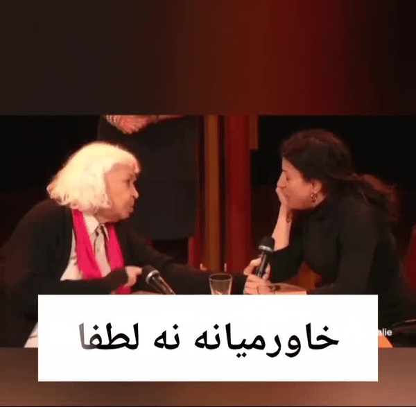
@mqdm_ir3 December 2025ادبیات استعماری☓خاورمیانه✓ غرب آسیا، شمال آفریقا#خاورمیانه #استعمار #غرب9 MB
@mqdm_ir4 December 2025رهبر معظم انقلاب: "منطقهی ما را میگویند خاورمیانه! خاورمیانه یعنی چه؟ یعنی اصل دنیا و مرکز دنیا اروپا است. بنده اصرار دارم نگویم خاورمیانه بگویم غرب آسیا. غرب آسیا است دیگر چرا میگوییم خاورمیانه."3 MB
محمد منصورمقدم Replied
@alirezamaghsoudi22 October 2025در باب تربیت و آموزش مدیران میانی و ارشد در فضای تولید چه در بخش دولتی و چه در بخش تعاونی و خصوصی در تلاشیم که یک کار جدی در کل کشور انجام دهیم. عزیزان اگر پیشنهادی در بهتر شدن این حرکت دارند پیام خود را یا به صورت کامنت یا خصوصی ارسال بفرمایند. #تولید_ملی#نیروی_انسانی_تولید
@mqdm_ir22 October 2025Replying toپیشنهاد بنده:در زمینه تربیت مدیران 1- جوانگرایی به معنای واقعی کلمه در نظر گرفته شود، همچنین آموزش مباحث اولیه (اما کامل) مرتبط با 2- دادکاوی و اهمیت داده و استخراج اطلاعات بر اساس آن برای تصمیمگیری و 3- هوش مصنوعی در نظر گرفته شود. همچنین در گزینش افراد، تعهد و تخصص باهم و بصورت لاینفک دیده شود.
محمد منصورمقدم Replied
@Amirreza1395_com27 July 2025Replying toالان اگر کسی اعتراض کند و بگوید تیم مذاکرهکننده هستهای حسن روحانی ملعون فریب خورده،لیاقت دریافت سکه نداشته و باید سکه ها را پس بدهند،باید دادگاهی بشوند بابت مکانیسم ماشه و توی هچل انداختن مملکت،ایا خلاف واقع گفته؟و تحت پیگرد قانونی قرار میگیرد؟!(اشاره به لایه جدید دولت به مجلس)
@mqdm_ir27 July 2025Replying toالبته باید دید ابزار و مرجع تشخیص محتوای خلاف واقع در نهایت چه خواهد بود و تفاوت بین خبر و اظهار نظر در محتوا و میزان اثر آن ديده میشه یا خیر ولی بهرحال اصل 24 قانون اساسی تصریح میکنه که مطبوعات و رسانه در بیان مطلب آزادند مگر آنکه مخل مبانی اسلام و حقوق عمومی باشد.
This post was deleted by the post author.
محمد منصورمقدم Replied
@Zafari_ali12 July 2025Replying toترجمه متن میشه :اسراییل از 7 اکتبر امسال روزانه 100 کودک را در غزه کشته
@mqdm_ir24 June 2025البته دقیقتر، منظور بنده، حفظ ظاهر دیپلماسی بود، چون در نبودش هم ما محکومیم و جهت افکار عمومی دنیا هم مهمه.با احترام
This post was deleted by the post author.
@mqdm_ir24 June 2025ما از آتشبس خنده بر لب نداریم، در میدان دیپلماسی خنده بر لب داریم و در پشت حواسمان جمع است، نیروی امنیتی و نظامی هم لنگ دیپلماسی نمیماند این همان ابتکار عمل و حربهای است که دشمن پیش گرفته است.
@ARIAIIIIII24 June 2025Replying toچرندیات قشنگی نوشته بودیاما مسئولان ایرانی و وابستگانشان در کمترین زمان ممکن برای بعداز جنگ بودجه های هزارمیلیاردی تصویب و بین خودشان تقسیم میکنند...این کارهایی رو که شما گفتیدشمن از صبح شروع کرده تا قوی تر شودو ما باز روز حمله غافلگیر میشویممسئولان بی کفایتمردم بیخیال و سرخوش…Show more
@mqdm_ir24 June 2025Replying toشاید منظور بنده را بد متوجه شدید:https://virasty.com/mqdmir/1750761678509489026https://virasty.com/mqdmir/1750761995912684475البته دقیقتر، منظور بنده، حفظ ظاهر دیپلماسی بود، چون در نبودش هم ما محکومیم و جهت افکار عمومی دنیا هم مهمه.با احترام
@ARIAIIIIII24 June 2025Replying toشما مطلب انصاری رو باز نشر داده اید که از نوچه های مدباقررر و پروژه بگیران جمعیت وفاقیون هستشانصاری و فرهاد فتحی و ... لشکریان فجازی خالیباف برای تخریب بچه های حزب الهی هستداحتمالا نوچه های خالیباف پروژه های جدید گرفتن؟؟درسته؟
محمد منصورمقدم Replied